The Badrinath Road Map includes a detailed course for the pilgrims to cross the most amazing and serene regions of the Garhwal Himalayas. Starting from Delhi which is in the distance of around 525 kilometers, the route will take the tourists to the landmarks which are important such as Haridwar, Rishikesh, Joshimath, and ultimately the Badrinath Dham. The path leads the adventurers along curved roads that reveal stunning river confluences, viridian valleys, and snow-capped peaks. In this blog, we take you on a complete roadmap of Badrinath Yatra, following step by step.

Road Route from Haridwar to Badrinath
- Haridwar to Rishikesh (Distance: Approx. 24 km): The journey starts from Haridwar, and you have to travel towards Rishikesh, a holy town, which is located on the river bank of the Ganges.
- Rishikesh to Devprayag (Distance: Approx. 74 km): From Rishikesh, follow the path to Devprayag where Alaknanda and Bhagirathi rivers join to form the Ganges.
- Devprayag to Srinagar (Distance: Approx. 35 km): Please note that Srinagar is not to be confused with the capital of Jammu and Kashmir. This town is situated on the banks of the Alaknanda River.
- Srinagar to Rudraprayag (Distance: Approx. 34 km): The road goes to Rudraprayag, another junction town where Alaknanda and Mandakini rivers meet.
- Rudraprayag to Karnaprayag (Distance: Approx. 34 km): From here, move to Karnaprayag, where the Alaknanda and Pindar rivers merge.
- Karnaprayag to Nandaprayag (Distance: Approx. 21 km): You have to travel to Nandaprayag, where the Alaknanda and Mandakini rivers meet.
- Nandaprayag to Chamoli (Distance: Approx. 18 km): Travel to Chamoli, which serves as the administrative center of the Chamoli District.
- Chamoli to Joshimath (Distance: Approx. 60 km): From Chamoli, proceed towards Joshimath, a main base point for the Badrinath Yatra.
- Joshimath to Badrinath (Distance: Approx. 44 km): Finally, it is the last leg of your tour that takes you from Joshimath to Badrinath. The ride is very steep and leads through a mountainous area with offers picturesque scenery to cherish forever.
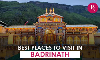
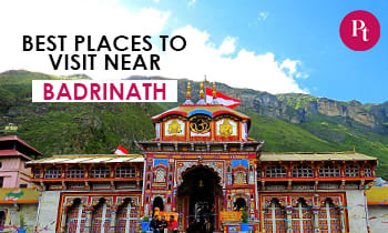
- Badrinath: You can also visit the revered Badrinath Temple, one of the top four sites of pilgrimage. It is dedicated to Lord Vishnu when you arrive at Badrinath.
Reaching Badrinath by Different Modes of Transportation:
By Road:
For most pilgrims, it is more common and convenient to travel to Badrinath by road. The scenic route has mountain terrains which requires perseverance. Here’s how to do it:
- Starting Point: The starting point depends on your location and would be from cities like Haridwar or Rishikesh in Uttarakhand.
- Route: You will follow the road that passes through small towns such as Devprayag, Rudraprayag, Karnaprayag, Nandaprayag, Chamoli, and Joshimath before getting to Badrinath.
- Distance: The whole road distance between Haridwar and Badrinath is approximately 315 km and it takes around 10-12 hours, depending on road conditions.
By Train:
The closest railway station to Badrinath is Rishikesh, which is well-developed in many cities of India. From Rishikesh to your destination, you’ll travel by road.
- Train: Reach Rishikesh by train and get down at the Rishikesh Railway Station.
- Road Journey: From Rishikesh onwards, you can hire a taxi or use public transport to travel to Badrinath via the road route which has been described earlier.
By Air:
The nearest airport to Badrinath is the Jolly Grant Airport in Dehradun, which is around 314 kilometers away. From the airport, you’ll have to travel the distance by road to get to Badrinath.
- Flight: Off to Jolly Grant Airport in Dehradun by air.
- Road Journey: Request a taxi or make use of the public transportation system to arrive at Badrinath Resort through the above-mentioned motorable road.
By Helicopter:
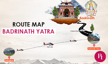
Not only road services but helicopters can be used by pilgrims who are looking to arrive at the place of Badrinath quickly and comfortably. The helicopter services work from locations like Dehradun and Phata.

- Helicopter Service: Book a helicopter service from Dehradun or Phata to Badrinath.
- Aerial Journey: Enjoy a scenic ride in the helicopter over the Himalayas and reach Badrinath in a shorter time.
Badrinath Road Map for Different Cities of India
1- Road Route from Delhi to Badrinath:
- Let’s begin with Delhi, the capital of India.
- Drive to Haridwar via the NH334 or the NH334B.
- Follow the route that starts from Haridwar to Rishikesh and then head towards Badrinath as mentioned before.
- The total distance from Delhi to Badrinath is around 530-550 kilometers and the journey takes approximately 15-16 hours.
2- Road Route from Mumbai to Badrinath:
- Start your journey in Mumbai, India (Maharashtra).
- Reach Vadodara (Gujarat) through NH48.
- From Vadodara, reach Udaipur, Rajasthan via NH48 and NH27
- Proceed to Ajmer and Jaipur, Rajasthan, via NH48 and NH248
- Drive to Delhi and then follow the route to Badrinath that was described earlier.
- The total distance from Mumbai to Badrinath is roughly 1,800-1,950 km, and the journey takes about 30-35 hours.
3- Road Route from Kolkata to Badrinath:
- Let’s start the journey in Kolkata, West Bengal.
- Drive towards Varanasi, Uttar Pradesh, via NH19.
- From Varanasi, go to Allahabad on National Highway 19.
- Head to Kanpur and then to Delhi via NH19 and NH44.
- Follow the route from Delhi to Badrinath as described earlier.
- The total distance from Kolkata to Badrinath is around 1,600-1,700 kilometers. The trip can take around 28-32 hours.
4- Road Route from Chennai to Badrinath:
- Start the journey in Chennai, Tamil Nadu.
- Drive for Bengaluru, Karnataka, by NH48.
- Travel from Bengaluru to Hyderabad, Telangana via NH44
- Drive to Nagpur on NH44 via Maharashtra.
- Head towards Jabalpur, Madhya Pradesh, by NH44.
- Drive to Delhi and then follow the route to Badrinath as described earlier.
- The total distance from Chennai to Badrinath is about 2,600-2,700 km and the journey can take around 40-45 hours.
Distance Chart of Badrinath from Different Cities of India
- Rishikesh – Badrinath 298 km
- Auli – Badrinath 34 km
- Gaurikund – Badrinath 233 kms
- Valley of Flowers – Badrinath 68 km
- Kotdwar – Badrinath 325 km
- Kausani – Badrinath 203 km
- Almora – Badrinath 245 km
- Delhi – Badrinath 525 km
- Jaipur – Badrinath 801 km
- Kolkata – Badrinath 1725 km
- Pune – Badrinath 1950 km
- Mumbai – Badrinath 1937
- Bangalore – Badrinath 2498 km
- Hyderabad – Badrinath 2072 km
- Chennai – Badrinath 2692 km
- Kochi – Badrinath 2993 km
- Ahmedabad – Badrinath 1512 km
Travel Tips
- Weather Check: Badrinath is exposed to harsh weather conditions; that’s why you should check the weather forecast before planning your journey and pack properly.
- Altitude Sickness Precautions: Badrinath is located at higher altitudes, so ensure proper acclimatization. Drink lots of water and don’t overdo the physical activities.
- Permits and Permissions: If you are from outside India, make sure you have all the required permissions and paperwork before you travel. Some areas would need a permit to enter whereas others require special permission.
- Road Conditions: The way to Badrinath can be tough, you have to struggle against all the hills and bends. Drive slowly and if possible the daytime.
- Accommodation: The accommodation options are a few which is more noticeable during peak seasons. It’s rather recommended to make a reservation in advance.
- Medications and First Aid: Bring along necessary medications and have a small first aid kit. Medical centers in remote areas can be understaffed.
- Cash and ATMs: ATMs are hard to come by in rural areas, so make sure you have enough cash for your expenses.
- Local Cuisine: Taste the local food, but pay extra attention to the hygiene standards, especially when it comes to street food.
Frequently Asked Questions
Q- When is the best time to undertake the Badrinath Yatra?
A- The most suitable seasons are the summer months of May-June and September.
Q- How do I obtain the necessary permits for the Yatra?
A- One can obtain permits from state tourism offices or via online Yatra registration portals.
Q- Is the Yatra suitable for senior citizens?
A- While the route includes a bit of hiking, it can be done by those with reasonable physical condition.
Q- Are accommodation facilities available along the route?
A- Yes, rest houses and Dharmashalas are available for pilgrims.
Q- What is the significance of Mana Village?
A- The village of Mana is famous as the place where the Mahabharata was composed and it provides a distinct cultural experience.




 Call
Call WhatsApp
 Enquiry
badri natgh jane ke liye helicopter ki sewa kahan se suro hai aut kitna charges hai up down